Showing posts with label archaeology. Show all posts

Thursday, 22 July 2010

New henge at Stonehenge


by Kathryn Hadley,

The University of Birmingham announced this morning the discovery of a new henge less than one kilometre away from Stonehenge. The new henge was discovered by a team of archaeologists led by the University of Birmingham and the Ludwig Boltzmann Institute for Archaeological Prospection and Virtual Archaeology earlier this week, just two weeks into a three-year study that forms part of the international Stonehenge Hidden Landscapes Project. The project aims to map the Stonehenge landscape and to virtually recreate the prehistoric monument and its surroundings using the latest geophysical imaging techniques.

The new henge consists of a circular ditch aligned with Stonehenge, which measures 25 metres (82ft) in diameter (five metres less than Stonehenge). It has two opposed north-east/south-west entrances and surrounds a smaller circle with internal deep pits that are up to one metre in diameter and could have held a free-standing timber structure. It is believed to be contemporaneous to Stonehenge, dating back to the Late Neolithic period between approximately 2,900 and 2,200 BC.

In the words of Professor Vince Gaffney from the University of Birmingham’s IBM Visual and Spatial Technology Centre, the finding ‘is remarkable’. In an interview with the BBC, he explained that ‘a major ceremonial site of this type or of this significance’ had not been found for over 50 years.

The discovery has raised many new questions about Stonehenge and the surrounding landscape, which archaeologists hope to solve as the Stonehenge Hidden Landscapes Project progresses.

According to Professor Vince Gaffney,

‘it will completely change the way we think about the landscape around
Stonehenge. People have tended to think that as Stonehenge reached its peak it
was the paramount monument, existing in splendid isolation. This discovery is
completely new and extremely important in how we understand Stonehenge and its
landscape.’

Professor Wolfgang Neubauer, Director of the Ludwig Boltzmann Institute, added:

‘This is just the beginning. We will now map this monument using an array of
technologies that will allow us to view this new discovery, and the landscape
around it, in three dimensions. This marks a new departure for archaeologists
and how they investigate the past.’

Mr Paul Garwood, prehistorian at the Institute of Archaeology and Antiquity at the University of Birmingham, said:

‘This discovery is of great importance for our understanding of the Stonehenge
landscape in the 3rd millennium BC. Its location, a short distance from
Stonehenge, and the fact that the two monuments were inter-visible, raises
exciting new questions about the complex sacred landscape that existed around
Stonehenge when the sarsen and bluestone monument was constructed.’

Prior to the construction of the iconic monument which survives today, there existed an earlier bluestone structure which was dismantled. In March 2008, archaeologists began, for the first time in 40 years, a new series of excavations at Stonehenge in an effort to throw new light on the origins of this little understood structure. Anthony Johnson reports in Solving Stonehenge.


Images:
- The archaeological team on site at Stonehenge (professional images)
From left, archaeologist Eamonn Baldwin, University of Birmingham with archaeological geophysicist Dr Chris Gaffney of University of Bradford with Professor Wolfgang Neubauer, director of the Ludwig Boltzmann Institute for Archaeological Prospection and Virtual Archaeology in Vienna.
- Interpretation: visual representation showing site of ditches (grey), post holes (yellow) and barrow (blue)

Wednesday, 20 January 2010

Eadgyth: the oldest remains of an English princess

by Kathryn Hadley

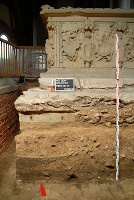
The University of Bristol announced today, January 20th, the recent discovery of the remains of the Saxon Princess Eadgyth, possibly the oldest member of the English royal family whose remains have survived. They were excavated from beneath an elaborate 16th-century monument bearing her name in Magdeburg Cathedral as part of a wider research project into the cathedral.

Eadgyth of Wessex was born in 910. She was the daughter of Edward the Elder, King of Wessex from 900 to 924, and his second wife Aelfflaed and was the granddaughter of Alfred the Great. She was given in marriage to Otto I by her step-brother Athelstan, who was king of Wessex from 929 to 939. Following his victory at the Battle of Brunanburgh in 937, Athelstan later became one of the first kings of a unified England comprising various Saxon and Celtic kingdoms. Otto I, also known as Otto the Great, succeeded his father Henry I as King of Germany in 936. He founded the Ottonian dynasty in Germany and, in 962, was crowned Holy Roman Emperor.

Eadgyth bore Otto at least two children before her death in 946, aged 36. The direct descendants of Otto and Eadgyth ruled Germany until 1254. Eadgyth was initially buried at the Monastery of Mauritius in Magdeburg. Her remains may thereafter have been transferred to Magdeburg Cathedral, but it was believed that the 16th-century tomb was most likely a cenotaph.

However, recent excavations of the tomb at Magdeburg Cathedral, directed by Professor Harald Meller and Dr Veit Dresely of the Landesmuseum fur Vorgeschichte in Saxony Anhalt, revealed a lead coffin bearing Eadgyth's name and recording the transfer of her remains in 1510. Inside the coffin, lay a female skeleton wrapped in silk, aged between 30 and 40.

Small samples from the tomb have been brought back to the University of Bristol for further analysis. A research group from the Department of Archaeology and Anthropology will measure the strontium and oxygen isotopes in the teeth and bone fragments in the hope that they will reveal where Eadgyth grew up and confirm the identity of the corpse.

Professor Mark Horton from the Department of Archaeology and Anthropology explained:

‘We know that Saxon royalty moved around quite a lot, and we hope to match the
isotope results with known locations around Wessex and Mercia, where she could
have spent her childhood. If we can prove this truly is Eadgyth, this will be
one of the most exciting historical discoveries in recent years’.


The findings will be announced at a conference entitled ‘Princess Eadgyth of Wessex and her World’ organised by the Centre of Medieval Studies at the University of Bristol this afternoon. Speakers will also present the current project to analyse the remains and place the discovery in the context of late ninth-century Mercia and Wessex.

Eadgyth is believed to be the oldest member of the English royal family whose remains have survived. The tomb of her brother Athelstan still exists in Malmesbury Abbey, Wiltshire, but is believed to be empty. Her sister Adiva was married to an unknown European ruler; the location of her tomb remains a mystery. However, with the recent discovery of Eadgyth's remains, 500 years after they were transferred to Magdeburg Cathedral, who knows what lies beneath Athelstan's tomb in Malmesbury Abbey?

For further information on Anglo-Saxon Britain, visit our Anglo-Saxon Britain focus page.

Images (Landesamt fur Denkmalpflege und Archaologie Sachsen-Anhalt, Juraj Liptak):

- the contents of the coffin

- excavation beneath the tomb

- inscription on the side of the sarcophagus, dated 1510

Thursday, 21 May 2009

Britain’s Maritime Heritage Is Vanishing!

by Kathryn Hadley

A recent deep-sea survey in the English Channel has revealed that Britain’s maritime cultural heritage has been considerably damaged as a result of the activities of the fishing industry and is in danger of being lost, forever.

The Royal Navy warship HMS Victory was lost in 1744 with Admiral Sir John Balchin, 1,100 sailors and 110 cannon. HMS Victory boasted the biggest cannon used in naval warfare and the largest collection of bronze guns. The 22-gun Marquise de Tournay was launched from Bordeaux as a French privateer and was captured and sunk by the British in 1757, allegedly on its way back from North America and the Caribbean. The wreck of the Marquise de Tournay is the only wreck of an 18th-century merchant vessel trading with the Americas to have been found in European waters. A 30-metre long merchant vessel, with a cargo of elephant tusks, iron cannon and manilla bracelet currency, was also lost in the mid 17th century.

These wrecks are just three of the 267 shipwrecks discovered in the English Channel during the recent survey carried out by Odyssey Marine Exploration. Covering an area of 4,725 square nautical miles, the survey is the most extensive archaeological survey of the western English Channel and the Western approaches ever undertaken. 115 (43%) of the 267 shipwrecks displayed permanent damage caused by trawlers and scallop dredges used by the international fishing industry.

HMS Victory and the wreck of the Marquise de Tournay lie within the most heavily fished section of the survey region and the 17th-century merchant vessel has been severely damaged by scallop dredges. Its hull has been almost completely destroyed and only a very small amount of its original cargo remains. Damage is caused to shipwrecks when trawlers plough the upper 6-20cm of the seabed to extract scallops and catch flatfish in nets weighing up to eight tons. Fishing vessels also cut furrows into shipwrecks, loosening archaeological deposits and dragging artefacts away from the sites. As the wrecks are exposed to oxygen, their wooden structures are broken up and the artefacts are washed away by currents.

In an article published on the website of The Times, Greg Stemm, chief executive of Odyssey Marine Exploration, described the damage caused to the wrecks:


‘When we got into this business, like everyone else we thought that beyond 50 or
60 metres, below the reach of divers, we’d find pristine shipwrecks. We thought
we’d be finding rainforest, but instead found an industrial site criss-crossed
by bulldozers and trucks.’

Dr Sean Kingsley, the Director of Wreck Watch International, a London based consultancy specialising in global maritime heritage, analysed the results of the survey. Ten key sites have been identified, which require further study, mapping, excavation and artefact recovery. The results of the project were published, yesterday, in a report which is available online http://www.shipwreck.net/publications.php

Odyssey’s study has been criticised, however, for overstating the damage caused to the shipwrecks. The Ministry of Defence has jurisdiction over warships’ remains and has asked English Heritage to carry out an assessment of threats to the site.

Throughout history the Channel has been of key strategic importance. It is estimated that the territorial waters of Cornwall, Devon, Dorset and the Isles of Scilly alone contain 7,000 shipwrecks.

For a history of the Channel Tunnel, read our article The Channel Tunnel

Pictures (from top to bottom):
- Cannon with plastic rubbish and sacking in the foreground (Photo courtesy of Odyssey Marine Exploration, © 2009)
- Dense fishing net caught on the side of a post mid-20th century wooden shipwreck
- 12-pounder bronze cannon recovered from the shipwreck site of HMS Victory, on the deck of the Odyssey Explorer. (Photo courtesy of Odyssey Marine Exploration, Inc. © 2008)

Monday, 11 May 2009

Pavlopetri: the preservation of the oldest submerged town in the world

by Kathryn Hadley

Pavlopetri lies three to four metres beneath the sea off the coast of southern Laconia in Greece. With parts of its ruins dating back to at least 2800BC, it is considered the oldest submerged town in the world. Some of the town’s buildings, courtyards, streets, chamber tombs and some 37 cist graves, from the later Mycenaean period (c.1680-1180 BC), have been preserved almost intact. The site is, nevertheless, in need of active efforts to preserve and document what remains of this period of Greek history. The coast of southern Laconia is a popular tourist destination and boats dragging anchors, snorkelers and the growth of marine life are a constant threat to the 3,500 year old walls.

The University of Nottingham announced, today, May 11th, the beginning of a project led by Dr Jon Henderson, from the Underwater Archaeology Research Centre (UARC) in its Department of Archaeology, to undertake a full underwater survey of the site. No work has been carried out on the site since it was first mapped using hand tapes, in 1968, by a team from the University of Cambridge. Dr Henderson is the first archaeologist to have official access to the site in 40 years.

Dr Henderson described one of the aims of the project:

‘This site is of rare international archaeological importance. It is imperative
that the fragile remains of this town are accurately recorded and preserved
before they are lost forever. A fundamental aim of the project is to raise
awareness of the importance of the site and ensure that it is ethically managed
and presented to the public in a way which is sustainable and of benefit to both
the development of tourism and the local community.’

The power of the Mycenaean civilisation was largely based on their control of the sea. However, archaeological studies have, to this date, mostly focused on better known inland palaces and citadels and their remains a lack of knowledge about the workings of harbour towns during the period. It is believed that Pavlopetri, in particular, with its sandy and well-protected bay, was an important harbour where local and long-distance trade was conducted throughout the Mediterranean.

The current project will research the history and development of the harbour, when it was occupied and what it was used for. A study of the geomorphology of the area will also seek to provide an insight into why the town disappeared under the sea. The first detailed digital underwater survey of the site will be carried out this month and in June, using an acoustic scanner which can produce three-dimensional digital surveys. There will be three further sessions of underwater excavations between 2010 and 2012. A study session is planned for 2013 and the results of the research are due to be published in 2014. Dr Nicholas Flemming, who first discovered the town in 1967, is also involved in the current project.

The Mycenaean civilisation was the first Greek-speaking civilisation, named after Mycenae, its most important site, in the Peloponnese of southern Greece. The population was ruled by a number of independent rulers, who each had their own stronghold. They notably conquered Crete in approximately 1450 BC, where they adapted the Linear A script to write their own language (Linear B). The Mycenaean period is also referred to as the Bronze Age period in Greek history and notably provided the historical setting for a considerable part of Ancient Greek literature and myth, including Homer’s Age of Heroes.
Pictures: above: outline of a building;
middle picture: one of the 37 cist graves
(University of Nottingham)

Friday, 8 May 2009

Discovering and Documenting Rome’s Catacombs

by Kathryn Hadley

The catacombs of Rome are a series of underground Christian, Jewish and pagan burial sites, which date back to the 2nd century AD, when the Christians of Rome began to bury their dead underground. There are over 40 catacombs in total, which extend over 170km (105 miles). In the 16th century, Antonio Bosio (1575-1629) explored the catacombs for the first time and research continued to the present day. Nevertheless, the catacombs have not yet been fully documented and, although the general lines of their development and origins have been studied, the individual history of each catacomb remains unknown. Due to safety concerns, only approximately 500 metres of the galleries are currently accessible to the public.

At the beginning of this year, however, a team of ten Austrian and Italian computer scientists, archaeologists and architects completed the first part of a three-year project to construct a virtual model of the catacomb of Saint Domitilla. The model enables you to travel through walls, down corridors and into chambers and to view some of the vivid paintings on the walls of the burials.

In an article published on the website of the BBC, Dr Norbert Zimmerman, the leader of the project, from the Vienna Academy of Sciences, described the model:
‘It is not a virtual image, it is not animation - what you are seeing is real
data […] Its moving, 3D flexibility, gives you the chance to compare areas, to
assess the ways the Catacombs were developed over time, to analyse how and why
those who built them did what they did. That's never been possible before.’

Saint Domitilla is the largest catacomb of Rome with tunnels, caves, galleries and burial chambers stretching over approximately 15km (9 miles) on a number of levels. It comprises a series of isolated pagan tombs and early anonymous community burials, which date back to the 3rd century. Burial activities ceased in Saint Domitilla in the 5th century, but, the catacomb was thereafter used as a pilgrimage sanctuary with the graves of the martyrs Nereus and Achilleus, until the Middle Ages. The catacomb includes 80 painted tombs, representing one of the largest inventories of catacomb paintings.

The project began in January 2006 in an attempt to create a three dimensional model of the catacomb using laser scanners. Between January 2006 and the beginning of 2009, nine separate scanning campaigns were carried out documenting the entire accessible area of the catacomb. Following the completion of the first part of the project, the images have now been returned to Vienna to be studied in more detail and scientists are currently working on the repertory of the paintings. In October 2008, it was decided that the project would be extended for a further three years.

Dr Zimmerman explained that there were no current plans to scan the whole of the complex:
‘That is a big job, but it may well be needed if we are to really understand
this incredible historical phenomenon and if we are to make a proper detailed
study whilst these caves are still intact.’

He also confirmed plans to make most the results of the project available to the public:
‘We will publish our findings to reveal, for the first time, just how impressive
these tombs were and how the people of that time went to so much effort to bury
their dead.’

For further information, visit the website of the project http://www.oeaw.ac.at/antike/institut/arbeitsgruppen/christen/domitilla_engl1.html

Wednesday, 29 April 2009

Dish of a thousand flowers brought back to life


by Kathryn Hadley

Millefiori literally means ‘a thousand flowers’. This morning, a Roman millefiori dish, recently discovered in East London, was revealed to the public for the first time at the Museum of London Docklands. The dish is considerably rare and a true feat of craftsmanship and the find is unprecedented, not only in London, but in the Western Roman Empire. Further research is currently being carried out in order to establish whether or not similar bowls have been discovered in the Eastern Roman Empire.

The millefiori dish, which is made up of hundreds of indented glass petals in an intricate repeated pattern, was both a feat to manufacture and a feat to restore. Millefiore is a glass-working technique created from glass rods with multi coloured patterns that are only visible at the cut ends. The rods are cut and the sections are thereafter assembled to create a larger piece. In this particular case, the pattern consists of blue petals bordered with white. The blue petals were originally embedded in a bright red opaque glass matrix, which is still visible around the rim of each section of the rod. The dish was found held together by the soil around it. When it was lifted out of the soil it broke into little pieces, however, which it took Museum of London Archaeology conservator Liz Goodman three weeks to reassemble.

In her words:


‘Piecing together and conserving such a complete artefact offered a rare and
thrilling challenge. We occasionally get tiny fragments of millefiori, but the
opportunity to work on a whole artefact of this nature is extraordinary. The
dish is extremely fragile but the glasswork is intact and illuminates
beautifully nearly two millennia after being crafted.’

The dish was unearthed during excavations, led by L-P: Archaeology, of the Eastern cemetery of Roman London in Prescot Street, Aldgate. It was found alongside other glass and ceramic vessels in the grave of a Roman Londoner. Excavation work on this particular part of the cemetery began last April and lasted until September. The dish was discovered in September towards the end of the excavation work. In accordance with Roman law, the cemetery would have been located outside the city walls of Roman London. The cemetery is believed to have been in use from approximately 80AD to 400AD and, to this date, it has revealed 50 inhumations (burials) and 30 cremations. Although very little is known about the cemetery because it is situated under a hugely built-up area of London, mostly under roads, it is estimated that it may spread over almost 16 hectares and that only 15-20% of the area has currently been excavated.

Considerable post-excavation work and analysis now remains to be done, both on the dish and grave, as well as on the cemetery as a whole. Who was the owner of the dish whose cremated remains were found alongside the grave goods? When does the dish date back to? Why does the cemetery include both inhumations and cremations and what determined whether a Roman Londoner was cremated or buried?

The complex manufacture of the dish suggests that it would have been a valuable and highly-prized item. This suggests, in turn, that its owner was relatively wealthy. The millefiori technique is believed to have been particularly fashionable in the 1st and early 2nd centuries. However, the vessels discovered with the dish are of a later date, from the 3rd century. The design of the millefiori dish is allegedly slightly different to those previously discovered which date to the 1st and 2nd centuries. It may thus be possible that the dish is from the 3rd century, from the same period as the vessels. Nevertheless, it is also possible that the dish was of an earlier date and was passed down from generation to generation, which seems even more likely if it was a highly valuable item.

Why some Romans were cremated and others buried also remains a matter of speculation. It is possible that Roman Londoners had different religious beliefs. Another possibility is that customs changed over time and, given that the cemetery span over 400 years of Roman occupation, this seems a plausible explanation. It is an explanation that requires, however, considerable further research in order to date each of the bodies.

For further information about the excavation work carried out at Prescot Street, including videos and photos of the digs, visit the project website:
www.lparchaeology.com/prescot

For further information on Roman Britain, including articles on Roman attitudes to their British subjects and how archaeological discoveries have overturned accepted views about the Roman invasion of Britain, visit our Ancient Rome focus page.
Pictures: the Millefiore Roman bowl; fragments of the bowl; and the bowl and other vessels as they were discovered (Museum of London)

Tuesday, 31 March 2009

More Information on the Achaemenid Empire

by Kathryn Hadley

A couple of weeks ago, I wrote a short piece about the South Korean diplomat in Iran, who had attempted to smuggle an inscribed stone from Perspeolis from the Achaemenid era out of the country. Officials in Shiraz airport caught the thief and sent the stolen piece back to the ruins of Persepolis, but he was eventually released due to diplomatic immunity!

Persepolis was just one of the capitals of the Achaemenid Empire, which flourished from approximately 550 to 330 BC and was, at its height, the largest empire of the ancient world. Susa was another of its capitals and was rebuilt by Darius the Great (in the picture on my previous post). Alexander the Great also married in Susa, which therefater became part of the Seleucid Empire.

I have just come across a very useful blog post, which describes in greater detail the history of Susa and also has fascinating pictures of some of the reliefs which decorated the palaces of Achaemenid kings, many of which are now in the Louvre in Paris. Another post on the same blog also describes a statue of Darius the Great, which was found during excavations of the Great Gate in Susa in 1972. It provides detailed pictures and also explains the various inscriptions on the statue...

Well worth a visit if you are interested in finding out more about the Achaemenid Empire!

Thursday, 19 March 2009

Iceman Photo Scan: A glimpse of Oetzi, if you dare!


by Kathryn Hadley

To coincide with the opening of the ‘Mummies’ exhibition, the EURAC research institute in South Tyrol has recently launched the Iceman Photo Scan project, a revolutionary website which records the complete photographic documentation of the Iceman mummy. The website enables the user to view the entire mummified body and to zoom in to examine specific parts in incredible detail. The preservation conditions of the mummy prevent the public from having close access to the body and the project is thus aimed at providing an opportunity to discover the 5,300-year-old mummy without compromising its preservation.

Shots were taken from 12 different angles and almost 800 scans were necessary in order to map the whole body. Particular attention was paid to recording the tattoos on the mummy’s body, which it is possible to view in a special section of the website via high definition photos. A third section provides 3D photos of the mummy, which can be viewed using anaglyph glasses.

Visit the website http://iceman.eurac.edu. The Iceman Photo Scan website is also accessible via the homepage of the website of the EURAC institute - http://www.eurac.edu/
Above: Mummy of Imhotep, Vezir of Thebes, Egypt, 18th Dynasty, 1504 – 1492 BC, also on display in the exhibition 'Mummies: The dream of everlasting life' (Museo delle Antichità Egizie, Torino)

Tuesday, 10 February 2009

Discovery of 30 Egyptian Mummies


by Kathryn Hadley

Yesterday, the Egyptian government announced the discovery (reported by The Associated Press and Reuters) of approximately 30 Egyptian mummies inside a 2,600-year-old tomb at the necropolis of Saqqara, to the south of Cairo. The tomb was discovered at the bottom of a 36-foot deep shaft and the mummies were placed in niches along the tomb’s walls. Eight sarcophagi were also found, one of which contained another mummy. The other seven have yet to be opened, but it is believed that they also contain mummies. The tomb was described by Zahi Hawass, Egypt’s top archeologist, as a ‘storeroom for mummies’, which dates back to 640 BC at the time of the 26th Egyptian Dynasty, the last native dynasty to rule the Egyptian kingdom before it was overthrown by the Persians in 525 BC. The tomb is, however, situated at an older site, from the period of the Old Kingdom, approximately 4,300 years ago. Abdel Hakim Karar, an assistant to Hawass, dated the tomb to the Old Kingdom, possibly the Fifth Dynasty, which ruled from approximately 2,494 bc to 2,345 bc.

The majority of the mummies are poorly preserved and archaeologists have yet to identify the bodies and to explain why so many were placed in one room. The name Badi N Huri was engraved in the opened sarcophagus, but the wooden coffin inside did not bear a title for the mummy. According to archaeologists, it is unusual for mummies to be buried in niches as late as the 26th Dynasty. It is also rare to find preserved burials in well-known necropolises such as Saqqara, which served the nearby city of Memphis, the capital of Ancient Egypt, because the tombs were often raided by thieves in ancient times. In the words of Abdel Hakim Karar:


"Niches were known in the very early dynasties, so to find one for the 26th
Dynasty is something rare".

Excavations at Saqqara began 150 years ago and have since uncovered a necropolis of pyramids as well as tombs, mostly from the Old Kingdom. Excavations have primarily focused on just one side of the two main pyramids, the Step Pyramid of King Djoser, one of the largest ancient stone structures in the world dating from about 2,650BC, and the pyramid of Unas, the last king of the Fifth Dynasty. In December, two rock-cut tombs were notably found in the Saqqara necropolis, 400 metres south of the Step Pyramid, near the current discovery site. The tombs were both those of high officials: the first was that of Iya-Maat, who bore the title ‘supervisor of the king’s property’ and was responsible to King Unas for bringing stones from the quarries for the construction of the nearby tombs; the second tomb belonged to Thinh, a Fifth Dynasty singer and, in the words of the engraving at the front of the tomb, the ‘supervisor of all singers’ who was in charge of providing entertainers for the pharaohs.

The area where the current tomb was found, to the southwest of the main pyramids, remains relatively unexplored. According to Hawass, only 30% of Egypt’s pyramids have been uncovered.

For information on ‘mummy making’, read our article The Making of a Modern Mummy

Further information on the discoveries and excavations led by Hawass is available on the official website of Dr Zahi Hawass
www.guardians.net/hawass.

The website of the Friends of Saqqara Foundation also provides information on Dutch excavations at Saqqara. It is regularly updated with news of the latest discoveries and provides a useful history of the site of Saqqara
www.saqqara.nl

Tuesday, 20 January 2009

Trophy Heads: Gruesome Practices from the Nazca Civilisation

Nasca trophy head from a tomb at the site of Cahuachi (Field Museum 1694.170150)

by Kathryn Hadley
In 1925, the American anthropologist Alfred Louis Kroeber (1876-1960) discovered a series of ‘trophy heads’ at six different sites in the region on the southern coast of Peru at the heart of the Nazca civilization, which flourished from approximately the first to the eighth centuries AD. The lips of the heads were sewn together with cactus spines and all the heads featured a hole in the centre of the forehead through which a carrying rope was inserted. Their meaning has remained a myth, however, for the past 100 years. Were they war trophies? Were they the heads of venerated ancestors, which bore a religious significance and were used in rituals or offerings?

Recent research has, however, revealed the geographical origins of the trophy heads, providing new clues as to their significance. Archaeologists compared strontium, oxygen, and carbon isotope data found in the tooth enamel of 16 of the trophy heads, originally discovered in 1925 and currently held at the Chicago Field Museum of Natural History, with that from 13 mummified bodies buried in the Nazca region. The atomic structures of strontium, oxygen, and carbon vary by geographical location, thus reflecting where the person lived and his or her diet.

The results of the study, published online on December 11th in the Journal of Anthropological Archaeology, concluded that the trophy heads did not come from a distinct geographical region and that the individuals in the study consumed similar diets. The trophy heads came from the local Nazca population, rather than from a neighbouring enemy civilisation, thus hinting that they may have been used in rituals. Widespread depictions of trophy heads on painted pottery from the late Nazca period suggest that collecting and displaying trophy heads was a relatively common practice amongst the Nazca civilisation.

Nevertheless, researchers do not rule out that the heads may have also served as war trophies. Paintings on pottery often reveal warriors holding trophy heads, which may have come from warring in the Nazca area. Considering the extensive lifespan of the Nazca culture over more than seven centuries, it also seems likely that the role and purpose of trophy heads evolved over time.

In the words of Professor Kelly Knudson, the lead author of the study from Arizona State University:


"It is possible that the role of the trophy heads changed over time. It is possible that these individuals were sacrificed, but we don't have any evidence for that".

Italian Archaeologist Giuseppe Orefici, who has worked since 1982 excavating the ancient Nazca ceremonial city of Cahuachi, approximately 28 kilometres away from the modern city of Nazca, explained how:


"In 26 years of digging at Cahuachi, we have never come across any head used as a war trophy […] We are rather talking of 'offering heads' used in rituals. They belong to people of both sexes and in most cases they have been buried inside the ceremonial center. The images of disembodied heads in pottery and textiles are either representations of myths or indicate the high social status of the people who carry them".

Monday, 19 January 2009

Chemical Warfare in Roman Times

The body of one of the Sasanian attackers lay in the mine, still clad in his iron mail shirt, his helmet and sword near his feet. (Please credit as follows: Yale University Art Gallery, Dura-Europos Excavation Archive).

by Kathryn Hadley

In a recent colloquium held as part of the 110th annual meeting of the Archaeological Institute of America, Dr Simon James, from the University of Leicester, presented evidence for what may be the earliest archeological signs of “gas warfare”. He argued that around twenty Roman soldiers found in a siege-mine at the city of Dura-Europos, Syria, died not as a result of sword or spear, but instead through asphyxiation.

The site of Dura-Europos on the banks of the Euphrates was conquered by the Romans around AD 160. In approximately AD 256 it was, however, attacked and subjected to a violent siege by an army from the rising Sasanian Persian Empire. There are no written records of the attack, the dramatic story of which is merely told by archeological remains. The Sasanians notably employed mining operations in an attempt to breach the walls of the Roman city, to which Roman defenders responded with counter-mines.

By studying the position of the bodies of the Roman soldiers found in a tunnel entrance, Dr James concluded that they had been deliberately stacked there in order to hinder the advance of remaining Roman army. Evidence of bitumen and sulphur in the tunnels provided that vital clues: the materials were used to start fires, which when ignited give off clouds of choking gases. Scars of severe burns on the corpses confirm that the bodies were indeed set on fire.

Dr James explained how:
“Careful analysis of the disposition of the corpses shows they had been stacked
at the mouth of the countermine by the Persians, using their victims to create a
wall of bodies and shields, keeping Roman counterattack at bay while they set
fire to the countermine, collapsing it, allowing the Persians to resume sapping
the walls. This explains why the bodies were where they were found. But how did
they die? For the Persians to kill twenty men in a space less than 2m high or
wide, and about 11m long, required superhuman combat powers – or something more
insidious.”

“The Persians will have heard the Romans tunneling and prepared a nasty surprise
for them. I think the Sasanians placed braziers and bellows in their gallery,
and when the Romans broke through, added the chemicals and pumped choking clouds
into the Roman tunnel. The Roman assault party was unconscious in seconds, dead
in minutes.”

Ironically however, this Persian mine failed in the end to destroy the city walls. Archaeological evidence reveals, nevertheless, that the Sasanians did manage to break into the city. Its inhabitants were massacred or deported to Persia and the city was abandoned forever. The site was only rediscovered in 1920. Recent excavations are part of a new research project on the archeology of Dura in order to build on previous campaigns of excavations conducted French and American teams in the 1920s and 1930s.

For more information about the history and archaeology of Dura, visit
http://www.le.ac.uk/archaeology/stj/dura/index.htm
For more information on the Archaeological Institute of America and its last annual meeting, visit
www.archaeological.org
For further general information on the relationship between the Roman Empire and Syria, read our article The Syrian Cuckoo: Rome and the Unconquered Sun

Thursday, 18 December 2008

Glimmer of Sudan’s rich cultural history

by Kathryn Hadley

Three ancient statues engraved with a little understood sub-Saharan language have recently been unearthed at the archaeological site of el-Hassa, approximately 120 miles north of the Sudanese capital, Khartoum. For the past six years, since the beginning of the conflict in Darfur in February 2003, Sudan has tended to feature in the news primarily as an area of war and atrocities. The recent discoveries provide, however, an insight into the richness of the country’s past and cultural history.

The statues represent three rams symbolising the god Amun and are engraved with a royal dedication in Meroitic script. The Meroitic script is possibly the oldest written sub-Saharan language, dating from the Meroe period, between 300BC and AD450. The language is relatively unknown and experts are now attempting to decipher the inscriptions. The excavations, which are being financed by the French foreign ministry, began in 2000 and have since revealed substantial information on the reign of the king Amanakhareqerem, who is also mentioned in the inscriptions on the rams.

In the words of the French archaeologist Vincent Rondot, the leader of the project:
It is one of the last antique languages that we still don't understand. We can read it. We have no problem pronouncing the letters. But we can't understand it, apart from a few long words and the names of people... It is absolutely essential to understand it... We only need to read the last words remaining on the inscription
The Meroitic kingdom of Sudan was situated around the Sixth Cataract of the Nile. It developed independently of Egypt, which had previously exerted considerable influence on the region. At the height of its power, during the second and third centuries BC, the Meroitic kingdom extended from the Third Cataract of the Nile to Soba in the South. The rulers of Meroe appear to have remained, however, influenced by the Pharaonic tradition. They erected stelae to commemorate their achievements and constructed pyramids to contain their tombs.

In the first century BC, however, they gradually changed their writing style from hieroglyphs to the Meroitic script, which was adapted to the indigenous Nubian language. The Meroitic kingdom gradually declined in the fourth century as the Ethiopian kingdom of Aksum in the East expanded; by AD350, King Ezana of Axum had captured and destroyed Meroe city.

The project is described on this website, from the French Ministry of Foreign Affairs.

The History Today archive has featured Sudanese history in its latter stages, most notably in articles on the 1888 Fashoda Incident, and covering the British General and Victorian hero Gordon's raid on Khartoum.

Friday, 12 December 2008

Evidence of Early Contact with Islam

by Derry Nairn

Antiquity, an Archaeology quarterly, reports in its December issue on the often under-reported historical incidences of contact between Britain & Ireland and Islamic cultures. In a fascinating article, Andrew Petersen documents the different types of archaeological finds which suggest interaction through the centuries.

Pottery, glass and ceramics originating in the Middle East, Moorish Spain, or merely bearing the influence of Islamic art have been found in sites throughout both Ireland and Britain. These can date from as early as the ninth century. Arab dinars are among the coins that have been found in Scandanavia, a relic of Viking raids on these shores.

However, perhaps the most surprising element of the brief review to the non-specialist reader is the indirect but strong influences which Islam held over early modern British and European architecture as a whole. The author traces a line from seventh-century Palestine (the Gothic arch) and ninth-century Iraq (the Tudor four-centre pointed arch) through to prominent Mughal-influenced British buildings such as Brighton's Royal Pavillion.

Petersen quotes no less an authority than Christopher Wren as saying:

'what we now vulgarly call the Gothick, ought properly and truly be named Saracenick Architecture refined by the Christians'

(Wren, C. 1750. Parentalia: or memoirs of the family of Wrens, taken from Sweetman, J. 1991. The Oriental obsession: Islamic inspiration in British and American art and architecture, 1500-1920. Cambridge: Cambridge Univ. Press)

The content of the article is all the more interesting given the prevailing interests expressed in the media on relations between resident Islamic communities and European society as a whole. Also of note, next year, 2009, marks the 120th anniversary of Britain's first purpose-built mosque: the Shah Jahan mosque in Woking, Surrey.

Read these free articles from our archive :


Friends or Foes? The Islamic East and the West

Christopher J. Walker asks whether the two religions that frequently appear locked in an inevitable clash of civilizations in fact share more than has often been thought.


Veiled Politics
Zephie Begolo discusses the symbolic power of the veil in Iranian politics, and its consequences for women, before and during the Islamic Revolution.


Tuesday, 9 December 2008

China, Archaeology, Xinjiang & Oil

by Derry Nairn

A fascinating article over at Archaeology Magazine's blog covers how ancient discoveries can have meaning for the present and deep ramifications for the future. The author, Heather Pringle, eloquently describes how she sometimes has to justify her study of objects and times past, a sentiment common to those of us in history publishing:
People often ask me why I write about archaeology. I can see from their puzzled looks that they think of archaeology as something irrelevant, so musty and obscure and distant from modern life that it scarcely warrants serious attention from a journalist. Indeed, whenever I have a conversation with my older brother, a successful lawyer, about book ideas I have, he looks at me with genuine concern. “Do you think anyone will be interested in that?” he asks in bewilderment
The article then goes on to describe how mummies excavated in Xinjiang, a predominantly Muslim and separatist Chinese province, have been seized upon by locals as proof that their ethnic grouping has ancient claims to the land. Unsurprisingly, the Chinese government is reluctant to admit to anything which would challenge their established territorial claim over oil-rich Xinjiang province. And so requests to release the mummies for DNA tests have been refused.

Read the full article at Archaeology Magazine's blog.

Read about the grand imperial history of Islamic central Asia in Francis Robinson's A Forgotten Region

Friday, 5 December 2008

The Richest City Under the Sun

by Derry Nairn

Two centuries before Alexander the Great was born, a pre-Islamic Persian empire was the largest the world had ever seen. Its capital, Persepolis, was known as 'the richest city under the sun', and today is still revealing ancient treasures to archaeologists. George Mason University's History News Network website reports on the news of the recent unearthing of a workers' district outside the city walls. Called Parsa, this 'gritty working-class district' was where the artisans who served Persepolis' rulers may have lived.

One of the directors of the joint Iranian and Italian teams responsible for the find said:
one of the trial trenches yielded a kiln for pottery making, while the other was characterized by the presence of a large number of successive dump pits extremely rich in pottery shards, bricks, charcoal, and bones
The story was first published by Juan Cole's Informed Comment blog, where you can also find an excellent clip from the Persepolis Recreated documentary.

Monday, 1 December 2008

Discovery of 5,500-year-old human settlements in Peru


by Kathryn Hadley

El Comercio newpaper reports that recent excavations have revealed evidence of 5,500-year-old human settlements in the Palpa Valley region on the South coast of Peru, approximately 400km South of Lima and just North of Nazca. The group of homes and nineteen graves are believed to represent the first evidence of human settlement from the late archaic period, approximately 3,500BC, ever discovered in southern Peru.

The remains are suggestive of simple houses with walls and roofs constructed of branches and sticks. Some of the graves include sculpted bones and snail shells as well as necklaces and bracelets. No concrete evidence of offerings to the dead or to deities was found, however, and researchers have consequently concluded that there were not significant social distinctions amongst the inhabitants. One of the graves was, however, different: it included the body of a child younger than one year old, which appeared to have been mummified.

The findings are part of a large scale research project led jointly by the two Peruvian archaeologists, Johny Isla Cuadrado and Elsa Tomasto, and by the German archaeologist Markus Reindel from the Deutsches Archaologisches Institut. The project aims to research the cultural history of the Palpa region from its beginning until the end of the pre-Hispanic period, at the time of the Spanish conquest in 1532, which saw the downfall of the Inca civilisation.

Although the southern coast of Peru has been investigated archaeologically since the early twentieth century, systematic excavations and the number of scientific publications on the area remain scarce.

The region is also the site of the mysterious Nazca lines, the series of geoglyphs which cover approximately 450 square kilometres and depict living creatures, imaginary beings, as well as geometrical figures. The figures are scratched in the surface of the desert and are believed to date from the Nazca civilisation, from approximately 200BC to 800AD. The longest line is 12 kilometres long and the drawings are only visible from the sky. Their purpose and meaning remain a mystery; various theories suggest that they were created as astronomical observation lines or were used in religious rituals.

Friday, 21 November 2008

Fly through Ancient Rome

by Derry Nairn

Google have implemented an exciting version of their Google Earth software that allows users to explore a virtual version of Ancient Rome in three dimensions. Other 'virtual maps' exist but this is the most thorough and usable version we at History Today have come across.

The following video offers a brief glimpse of what is possible using the application. A quick tour of three sites - the Colusseum, the Basillica Julia and the Temple of Vesta - demonstrate that users can not only see the physical, external landscape of the city, but details such as stucco and marbling of interiors as well.


The project was co-ordinated with the team behind the Rome Reborn 3d model, created at the University of Virginia in the United States. They backed up Google technology with archaeological and contextual data, which is accessible from within the map application.

For more information on using Google Earth, please click here.

Tuesday, 18 November 2008

Neolithic Nuclear Family Discovered


by Derry Nairn

The discovery of a number of neolithic graves in Germany have suggested the earliest evidence of nuclear families. Four 4,600 year old graves have been excavated in Germany, and the remains of their 14 occupants analysed. Using mitochondrial and nuclear DNA techniques, and the patterns of burial, experts then concluded the relations between the buried.

One grave contained an adult man, an adult woman and two boys, all in close proximity. Another contained an adult female with three children. The first was reckoned to contain closely related individuals, and the second a group of siblings buried with their aunt or guardian. Wolfgang Haak, a geneticist at the Australian Centre for Ancient DNA in Adelaide, claims these finds have "established the presence of the classic nuclear family in a prehistoric context."

The people were members of the Corded Ware culture, named after their practice of decorating pots using twisted cord. Unhealed injuries on the skeletons suggest they died in violent circumstances. Other evidence from the individuals' dental strontium isotope content suggest the men originated in the same area as they were buried, but the women came from afar.

Others hold doubts about the evidence. Marek Zvelebil, an archaeologist at the University of Sheffield observed that the genetic markers the Adelaide team used are "very widespread in Europe." The orientation of older graves, some dating back 9,500 years, have suggested nuclear family relations. However these are less easily established without DNA evidence.

Read more on prehistory & archaeology....

Monday, 10 November 2008

Unearthing the mysteries of Eaglesfield Park

by Derry Nairn

A-level students from Plumstead Manor School in Greenwich surveyed the lay of the land at Eaglesfield Park this week when they joined an archaeological dig at the historic site.


Working with students from Birkbeck, University of London, they used a variety of surveying techniques to try and detect any prehistoric features that might be buried beneath the surface.

Local archaeologist Andy Brockman said
This is the first time the London Borough of Greenwich and Birkbeck has co-operated on such a piece of public archaeology and education with the aim of involving the local community, amenity groups, and local history societies.
The students were instructed by a leading survey company with help from Birkbeck students and graduates. They used the latest technology, including electrical resistance surveying, magnetic surveying and Ground Penetrating Radar, to unravel some of the mysteries of Eaglesfield.

Birkbeck course organiser Harvey Sheldon said

Eaglesfield Park is on the highest ground in South London near the Thames and was a key strategic point. Channel 4’s Time Team located an Iron Age ditch here, and we’re looking for features and activity that might indicate such an ancient settlement. The day was a great way for the students to learn by doing hands-on research in the field.
Read a full-length History Today article about the world of the capital city in prehistoric times London before London

Friday, 7 November 2008

Drug use in ancient civilisations

The drug paraphenalia excavated with the Tiwakanu bodyby Derry Nairn

Two recent archaeological stories show that humanity has been using drugs on opposite ends of the earth for thousands of years.

In Chile, new tests on members of an ancient pre-Hispanic civilisation are showing clear signs of drug use. Graves of the Tiwanaku are often found to contain equipment for using hallucinogens, such as pipes. Recent experiments by the University of Tarapaca on the remains of an adult male buried with an elaborate snuffing kit have shown that his body contained significant samples of a hallucinogenic plant.

Professor Ogalde who led the project said that:
The presence of harmine suggests the Tiwanaku travelled in search of exotic hallucinogens, and brought the Banisteriopsis vine from as far as the Amazon rainforest, some 300 miles away
An answer to the question of why the drugs were used is more complex. Prof Ogalde suggested a therapeutic use. However traces of the chemical were also found in the body of an infant, clouding any clearly-defined explanation.

In a seperate discovery, as reported in the Sunday Times, bowls and pipes for mixing and inhaling hallucinogens were uncovered in a Stone Age grave on the Carribbean island of Carriacou. The North Carolina State University researchers who happened upon the equipment came to the conclusion that it originated in South America, over 400 miles away.

Richard Davenport-Hines is quoted in the newspaper report as saying
Drug use became widespread in many early agriculture-based societies simply because it was the only way people could cope with spending long hours working in the fields, often in horrible conditions like baking sun
Here are some related articles from recent History Today issues:
 
Blog Directory